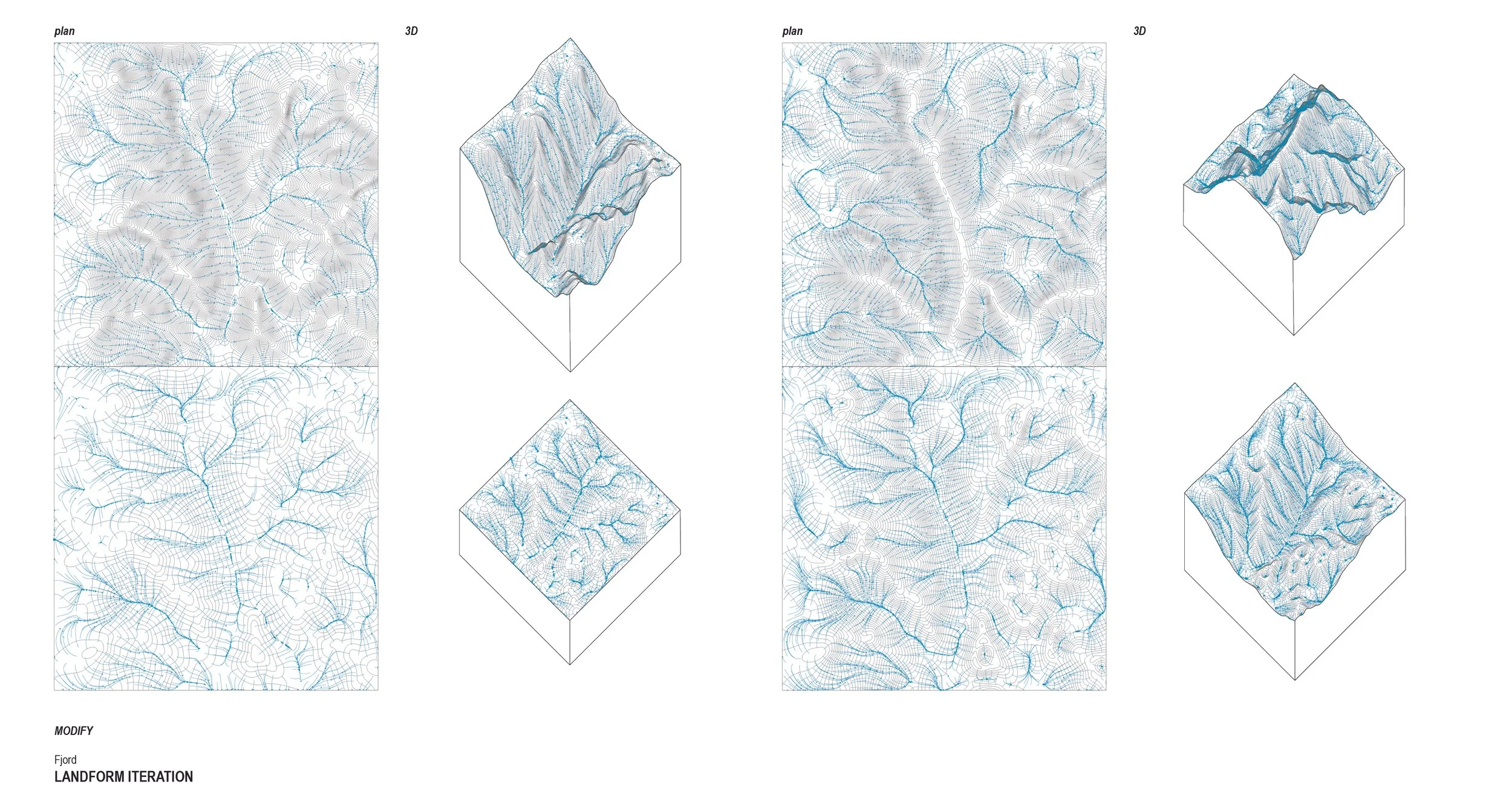
The Study of Fjord: Landscape Topography and Hydrology
Part 1. The Story
Formation - A fjord is a deep, narrow and elongated sea or lakedrain, with steep land on three sides. Fjord comes from the Norse fjǫrðr, meaning "where one fares through". The fjords are located on the edge of the large continents that were covered by the ice sheets that covered these areas over the past 2-3 million years. During the ice ages, the ice drained through deep valleys and fjords. The opening towards the sea is called the mouth of the fjord. In front of the glacier arm, there was deposited a moraine of gravel and sand that formed an underwater barrier, often called "sea thresholds" or "ra". These are the places where the fjord is shallow.Hydrology - In summer, fjords experience a significant inflow of river water in their inner areas, creating a layer of brackish water that flows from river mouths towards the ocean. In winter, with minimal freshwater inflow, fjord waters become more saline despite glacial contributions. This dynamic hydrology supports a unique marine biodiversity similar to that found in mangrove ecosystems. The formation of fjords is ongoing, with changes in the Earth's crust and continued glacial melting potentially reshaping these landforms.Part 2. The Site
Future - Fjords, formed by glacial activity, are vital indicators of climate change, reflecting the impacts of rising temperatures and sea levels. These unique landforms host diverse ecosystems, influencing biodiversity and providing essential ecosystem services. Fjords also play a role in natural hazard mitigation, tourism, resource extraction, and transportation, necessitating careful management to balance environmental conservation with human activities. Their significance extends to scientific research, offering insights into glacial processes, oceanography, and climate change, which are crucial for informing sustainable resource management policies.The site in located in the Kenai Fjords National Park in Alaska. Established in 1980, the park is renowned for its stunning fjords, glaciers, and abundant marine and terrestrial wildlife. It spans approximately 669,984 acres, encompassing the Harding Icefield, one of the largest ice fields in the United States, and numerous fjords carved by glacial activity.
One of the fjords at the national park was chosen to analyze its topography and hydrology.


